The flat-top of Kilimanjaro is not really so flat.

No, I didn’t shoot this image of Kilimanjaro and the giraffes. It is quite lovely. It came from here: https://www.marieclaire.co.uk/life/travel/mount-kilimanjaro-africa-612741
We summited Kilimanjaro at sunrise and lingered longer. None of us suffered significantly from the altitude and as the sun climbed higher and higher it almost felt warm. Ok, maybe it wasn’t really warm, but compared to the cold dark of the night, it warmed the heart.
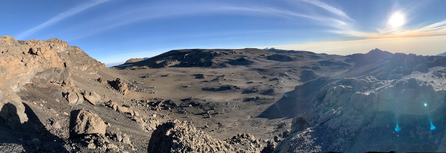
We took photographs of the shadow cast by the mountain, the surrounding clouds, and the lumpy flat-top. The whole thing had a lunar feel.
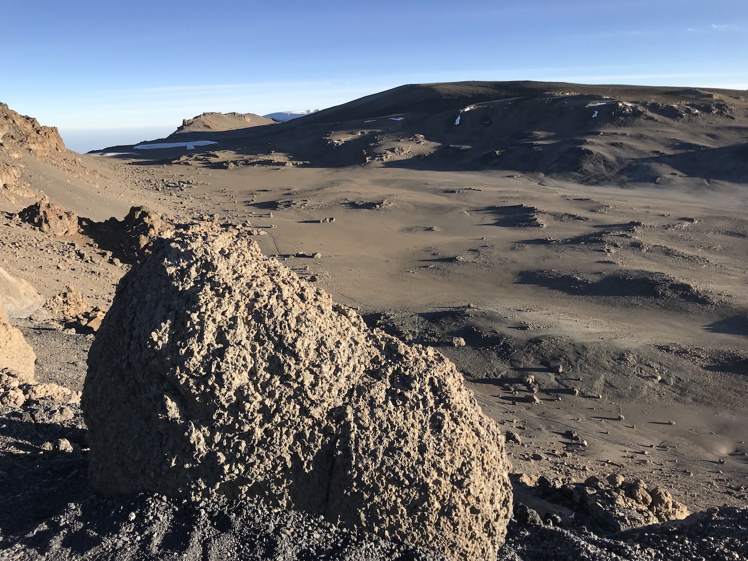
The picture above was taken from the eroded rim. In the center of the picture is a gentle rise where a deep pit can be found. We didn’t get close. From above, the Reusch Ash Pit looks like a series of telescoping circles that hint at Kibo’s true identity. Fumes still roil up from it (or so I’m told).
In my mind, mountains have a profile that looks like this:

In my mind, Kilimanjaro has a profile that looks like this:

No. That looks more like Batman. Let me try again.

That’s better. Now you can see the 30-degree slope that leads up to the the caldera, or the “cooking pot,” that occupies Kibo’s center. The caldera was formed when the magma chamber beneath this volcano emptied itself and the top of the mountain collapsed into its own throat (try to imagine how that went down!). Contemplate too, how much taller this mountain would have been before its collapse! Today the summit, known as Uhuru Peak, is actually located on the caldera rim.
The red flag marking Uhuru Peak in my drawing is a nice touch, don’t you think?
Here is our group (Bryan, Slaa, Karen, and myself) on the rim of the caldera, near Uhuru Peak.

For a short and cool presentation (better than my drawings!) to help visualize the creation and collapse of a volcano, check out this clip from our friends with the US Geological Survey.

Now, just to put a different spin on the end of things, recognize that the caldera that constitutes Kilimanjaro’s lumpy flat-top measures about a mile and a half across. The park we call Yellowstone is located on the top of four overlapping calderas. It measures between 30 and 40 miles in diameter! While not as high as Kilimanjaro, Yellowstone is truly a “supervolcano.”

Don’t be fooled. While it seemed a little warmer once the sun came out, our unprotected water bottles froze solid on Kibo’s summit. Check out Bryan’s Nalgene.
If you are a pastor, church leader, or educator, let me hear from you. I partner with faith-based groups to craft and deliver outdoor academic experiences in the lands of the Bible. Leaders receive the same perks that other agencies offer, at competitive prices, and without the self-serving interests that often derail pilgrim priorities. See our list of future trips here.